2017 GeoRodeo | Austin, Texas
Annual Texas GeoDeveloper Round-Up, May 22nd, Austin, Texas

Code, Code on the Range
TNRIS invites you to Austin on May 19th, 2017, for the 5th annual GeoRodeo - a roundup of geodevelopers, coders and any professional from across the state of Texas who is looking to incorporate new ideas and creative solutions into their work.
This free, interactive, technical conference, held at the Commons Learning Center of the JJ Pickle Research Campus, is geared towards the Texas GIS/geospatial developer community.
Join us to learn about tips and techniques for open data, open source, and commercial GIS applications. Browse the agenda to see what great topics to expect.
 Keynote Speaker
Todd Mostak
Founder & CEO at Heavy AI, Formerly MapD
Recognizing the possibilities behind the mechanics of Xbox and PlayStation, Todd rethought the standard for traditional data analytics. Replacing his CPU for a GPU, he was one of the first to discover the untapped potential of GPUs to analyze, visualize and explore data in ways never done. Now? He reduces query times from hours to milliseconds for Verizon, Amazon and Simulmedia, enabling them to spend significantly less time crunching data and more time analyzing to make key business decisions.
 Keynote Speaker
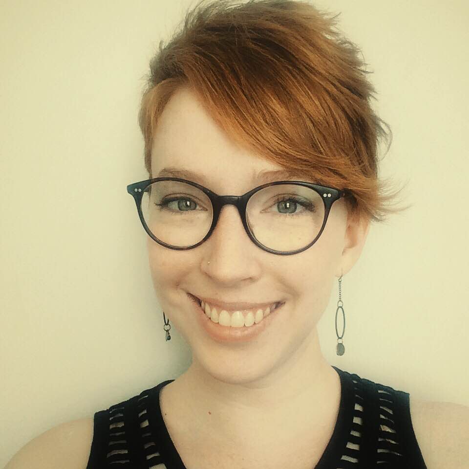
Sara Safavi
Software Engineer at Boundless
Sara Safavi is a software engineer at Boundless who writes free & open source software that helps other people do cool geo-stuff. She is a core contributor to the open source GeoNode project, and currently spends much of her time working on the nonprofit MapStory Foundation's GeoNode-based web mapping platform. Outside of work, Sara is an organizer for MaptimeATX and frequent speaker in the Python & geospatial tech communities.
Register On-Site
Online Registration is Now Closed. On-Site Registration is still available.
Sponsors


Agenda Overview
| 8:00AM to 8:45AM | Breakfast - Social |
| 8:45AM to 9:00AM |
Opening Remarks - Richard Wade |
| 9:00AM to 10:00AM |
Keynote Address |
| 10:00AM to 10:15AM | Break |
| 10:15AM to 11:45AM | |
| 11:45AM to 1:15PM | Lunch on your own |
| 1:15PM to 2:15PM |
Keynote Address |
| 2:15PM to 2:45PM | |
| 2:45PM to 3:00PM | Break |
| 3:00PM to 4:00PM | |
| 4:00PM to 4:30PM |
Lightning Talks |
| 4:30PM to 4:45PM |
Closing Remarks |
| 5:00PM |
Social at 4th Tap Brewery |
I am new to programming. Will I benefit from this?
Yes, this event is designed to help you make connections and provide some guidance for accomplishing your geospatial goals. There will be an emphasis on coding and breaking down the process for modern geospatial solutions.
Should I bring my own Laptop?
Yes, we encourage you to bring your own laptop loaded with whatever tools and code that you may want or need. There will be wireless internet connections available. Note: Make sure you have a fully charged battery to avoid power outlet ‘range wars’!
Agenda
Note: Agenda times subject to change.
8:00AM to 8:45AM
Breakfast – Social
Sponsored by 
8:45AM to 9:00AM
Opening Remarks
9:00AM to 10:00AM
Keynote Speaker
Todd Mostak, Founder & CEO at MapD
About Todd
Recognizing the possibilities behind the mechanics of Xbox and PlayStation, Todd rethought the standard for traditional data analytics. Replacing his CPU for a GPU, he was one of the first to discover the untapped potential of GPUs to analyze, visualize and explore data in ways never done. Now? He reduces query times from hours to milliseconds for Verizon, Amazon and Simulmedia, enabling them to spend significantly less time crunching data and more time analyzing to make key business decisions.
10:00AM to 10:15AM
Break
Sponsored by ![]()
10:15AM to 11:45AM
10:15AM to 10:45AM
Diana Turner, Brian Smith, Design, Technology, and Innovation Fellows, City of Austin
 Flooded by Information: A Redesign of ATXfloods
The City of Austin's Design, Technology, and Innovation Fellows program provides an opportunity for Austin’s passionate and civic-minded designers and developers to bring the principles, values, and practices of the technology sector into government. Inspired by the success of programs at 18F, Code for America, and the U.S. Digital Service, we partner with departments throughout the city to tackle some of their biggest challenges.
10:45AM to 11:15AM
Katherine Smyth, ESRI
 Join the Open Data Revolution
As a Solution Engineer at Esri, Katherine helps cities and counties create, maintain and use geospatial data to make decisions that help support their communities. She believes that sharing Open Data strengthens all communities and leads to innovation. When she isn't traveling to speak with local governments, she is likely doing archaeology or adventuring in the wilderness.
11:15AM to 11:45AM
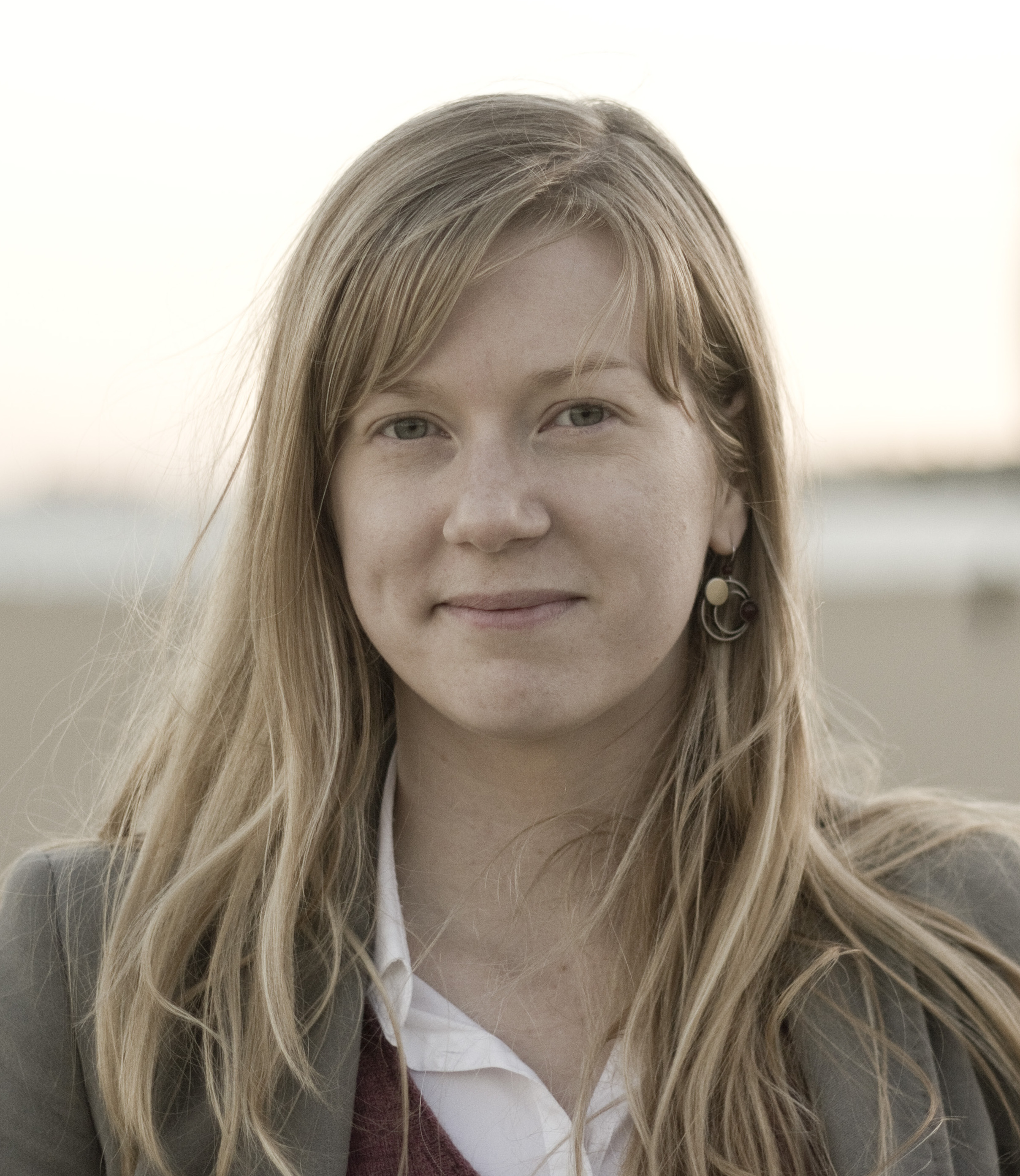
Glynnis Ritchie, UX Engineer
 Setting Fire to Silos: How to Bridge the Divide Between Development and Design
Glynnis is passionate about creative collaboration, interdisciplinary teams, and the spaces where elegant code and delightful experiences overlap. When she's not designing for the web, she designs books and print collateral for Big Class, a New Orleans nonprofit that cultivates and supports voices of writers aged 6 to 18. People also know her as a calligrapher, tea connoisseur, and tabletop gaming nerd.
11:45AM to 1:15PM
Chow Time
Lunch on your own. Here's a map of nearby lunch spots:
1:15PM to 2:15PM
Keynote Speaker
Sara Safavi, Software Engineer at Boundless
Sara Safavi is a software engineer at Boundless who writes free and open source software that helps other people do cool geo-stuff. She is a core contributor to the open source GeoNode project, and currently spends much of her time working on the nonprofit MapStory Foundation's GeoNode-based web mapping platform. Outside of work, Sara is an organizer for MaptimeATX and frequent speaker in the Python and geospatial tech communities.
2:15PM to 2:45PM
 Christine Doig, Continuum Analytics
Continuum Analytics' Anaconda is the leading Python distribution for data science. Continuum Analytics sponsors several open source projects, which help empower GIS professionals. Bokeh, one of the open source projects, allows users to create interactive web visualizations using a variety of languages include Python, R and Scala. Datashader is a Python-powered, bin-based rasterization pipeline, which can help visualize billions of data points in a single image. Dask is a flexible parallel computing library, which helps scale your code from single-core to multi-core to multi-machine. Explore these exciting open source projects sponsored by Continuum Analytics in this Python-heavy session designed for GIS professionals.
2:45PM to 3:00PM
Break
Sponsored by ![]()
3:00PM to 4:00PM
3:00PM to 3:30PM
Tim Renner, Data Scientist
Geo Data Science at HomeAway
HomeAway and Expedia’s mission is to “revolutionize travel through the power of technology.” Geography is at the core of matching travelers to relevant vacation rentals for their destination. In this talk, Tim will discuss some of the unique aspects and challenges when matching travelers to destinations in a two sided marketplace.
 3:30PM to 4:00PM
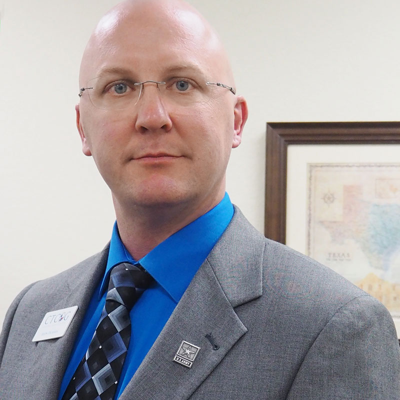
Jason Deckman, KTMPO
The Bike-Ped Map functions as both a geographic resource and a public engagement tool. Users can find existing bike lanes, trails, sidewalks, etc, as well as planned projects. Three publicly-editable layers allow people to suggest new projects or highlight gaps in the data. The Project App shows scoring and funding information for KTMPO projects listed in the MTP. I will discuss the challenges involved in configuring our local server and using the tools on ArcGIS Online to develop these apps.
4:00PM to 4:30PM
Lightning Talks
As we've done each year, we'll end the day with Lightning Talks, where any attendee can step up to present. If you have something quick to share, come prepared with an idea of what you could present within a short 5-minute time slot and sign up for a lightning talk on-site at the event.
Lightning Talk Rules
- 5 minutes max – We will tightly enforce this.
- No external computer laptops or tablets - only browser based access to materials and links.
- Tips: Understand your topic – make your point at the beginning. You don't have to use all 5 minutes.
4:30PM to 4:45PM
Closing Remarks
5:00PM
Social at 4th Tap Brewery
Location & Parking Information
COMMONS LEARNING CENTER
at the J.J. Pickle Research Campus
10100 Burnet Rd Austin, TX, 78753
Parking Pass
A parking pass is required at the Commons Center. Download, print and display prominently in your vehicle.
Download Parking Pass